
Monarcha | AI-Powered Geospatial Platform
Rate this Tool
Average Score
Total Votes
Select your score (1-10):
Detail Information
What
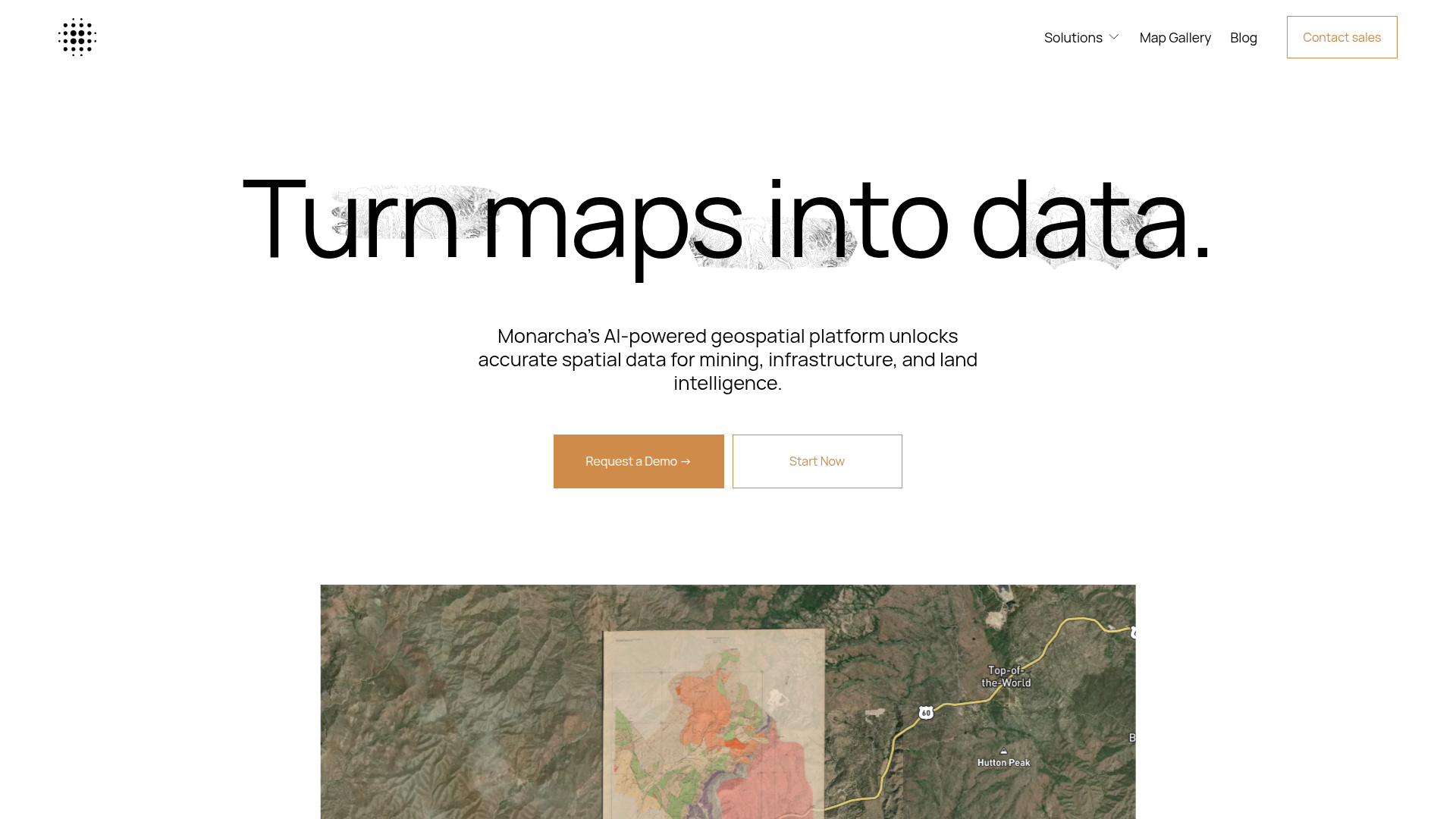
Monarcha is an AI-powered geospatial platform that converts maps and other land-related documents into structured spatial data. Based on the page content, it is designed for teams working in mining and resources, civil engineering, and related land intelligence workflows that need to turn static documents into usable GIS-ready information.
Its core workflow appears to be document ingestion, AI-based georeferencing, and extraction of spatial elements such as land descriptions, coordinates, and plotted geometries. The product is likely positioned as a specialized geospatial data processing tool for organizations that rely on scanned maps, plats, deeds, drawings, and similar records.
Features
- AI-powered georeferencing: Uses vision AI to georeference complex documents and make them queryable as spatial data.
- Fast document processing: The site states that georeferencing can be completed in 90 seconds or less, which may help accelerate map-to-data workflows.
- Structured spatial extraction: Converts each document into a dataset by extracting land descriptions, coordinates, and plotted geometries.
- Queryable GIS layer creation: Transforms text and imagery into GIS-compatible layers that can support downstream spatial analysis.
- Universal document ingestion: Accepts scanned maps, plats, deeds, drawings, PDFs, and images, which is useful for mixed-format archival and field documentation.
Helpful Tips
- Validate output on high-risk records: For legal, engineering, or resource decisions, teams should confirm extracted boundaries and coordinates against source documents and existing GIS standards.
- Start with a representative document set: Pilot the platform on a mix of clean and difficult files such as scans, annotated drawings, and legacy PDFs to assess fit for real operating conditions.
- Define downstream GIS requirements early: Before rollout, clarify how extracted layers will be stored, reviewed, and used across surveying, engineering, or land teams.
- Check exception-handling workflows: For this type of product, operational value depends not just on automation speed but also on how easily staff can review ambiguous geometry or incomplete source material.
- Assess document governance needs: If teams process deeds, plats, or engineering drawings at scale, they should consider naming, versioning, and provenance practices alongside ingestion.
OpenClaw Skills
Monarcha could be a strong upstream data source for OpenClaw workflows focused on land, infrastructure, and resource intelligence. A likely use case would be an OpenClaw skill that monitors incoming document batches, classifies them by type, sends them through Monarcha for spatial extraction, and then routes the resulting datasets into review, enrichment, and reporting workflows for land analysts, GIS teams, or project engineers. The page does not describe native OpenClaw connectivity, so this should be treated as a likely workflow pattern rather than a confirmed integration.
In a broader agent ecosystem, OpenClaw could support skills for title research triage, engineering document intake, mineral rights mapping, permit-area change detection, or map-library search over extracted geospatial attributes. Combined with Monarcha’s document-to-spatial conversion, these workflows could reduce manual interpretation of legacy records and shift professional time toward validation, decision-making, and cross-project spatial analysis.
Embed Code
Share this AI tool on your website or blog by copying and pasting the code below. The embedded widget will automatically update with the latest information.
<iframe src="https://www.aimyflow.com/ai/monarcha-ai/embed" width="100%" height="400" frameborder="0"></iframe>